Un Proyecto de Vicente (Tex) Hernandez


Acerca de los Ecos de Polaris
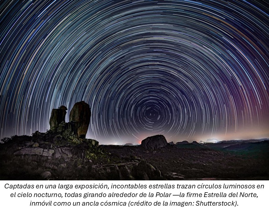
En la antigüedad y la época premoderna, la Estrella Polaris, también conocida como Estrella del Norte, más tarde llamada Stella Maris, era una de las referencias de navegación más importantes, especialmente en el hemisferio norte. En la época medieval, Polaris apuntó con confianza el norte verdadero, guiando a exploradores y navegantes a través de aguas vastas y desconocidas.
Hoy en día, la navegación ha evolucionado de forma espectacular gracias al uso de sistemas avanzados como el Sistema de Visualización y de Información de Cartas Electrónicas (ECDIS), que integra el Sistema de Posicionamiento Global (GPS), una tecnología que ahora es esencial no solo para los viajes marítimos, sino también para la vida cotidiana.
En un mundo tan dependiente de direcciones y orientaciones precisas, la metáfora de encontrar el "verdadero norte" sigue siendo profundamente relevante. Esta idea fundamenta mi trabajo: si buscamos un punto de referencia fijo y confiable en nuestras empresas y decisiones, ¿no deberíamos buscar también el significado más profundo de nuestras vidas, basado en los valores que realmente nos guían?
La selección de títulos presentados en este blog forma una matriz de ideas compleja pero complementaria, diseñada para fomentar el cuestionamiento y la reflexión. Creo, aunque por supuesto puedo estar equivocado, que la forma en que se introduce y desarrolla cada tema contextualmente es genuinamente innovadora.
Temas como el verdadero fundamento de la ciencia, el marco para un noviazgo feliz, la visión contracultural de la sexualidad, el control que debemos ejercer sobre nuestro propio destino y la importancia de la maduración de nuestro carácter no son asuntos aislados. Por el contrario, son expresiones interconectadas de los valores fundamentales que orientan nuestra vida.
Es posible que aquí no encuentres todas las respuestas que estás buscando, pero si un espacio para hacer pausa y reflexionar. Espero que estos pensamientos te ayuden a mantenerte anclado a lo que más importa: tu propia Polaris, iluminando el camino que has de seguir.
Vicente (Tex) Hernandez
No has llegado hasta aquí para detenerte. Añade tu correo electrónico a la lista de Suscripción gratuita para recibir notificaciones cuando se publique un nuevo artículo del blog.
Suscripción Gratuita
Preguntas Frecuentes sobre
La Navegación
¿Qué es el norte verdadero?
El Norte Verdadero simboliza un punto de referencia fijo en la vida, guiando nuestras decisiones y acciones.
¿Cómo encontrar dirección?
Identificando los valores fundamentales que necesitamos para navegar los desafíos que encontramos.
¿Qué es Polaris?
La Polaris representa la dirección que tenemos que tomar.
Navegación da sentido y propósito a la vida.
¿Cuál es la importancia de la navegación?
¿Qué hilo conductor une estas ideas?
Saber cuál es nuestro verdadero norte es clave para elegir con sentido y coherencia.


Galería
Un recorrido visual en busca del Norte Verdadero.


Zona de contacto y preguntas
info@echoepolaris.com
© 2025. Todos los derechos reservados.
Si tienes algún comentario o pregunta, no dudes en compartir tu dirección de correo electrónico.