A Life Project by Vicente "Tex" Hernandez


About Echoes of Polaris
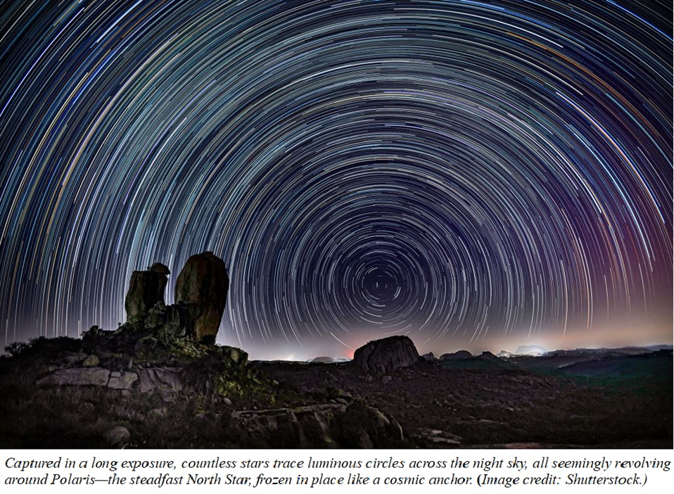
Not long ago, in ancient and pre-modern times, the Polaris Star—also known as the North Star, later called Stella Maris—was one of the most important navigation references, especially in the Northern Hemisphere. Since medieval times, Polaris has reliably pointed toward true north, guiding explorers and seafarers across vast and unknown waters.
Today, navigation has evolved dramatically with the use of advanced systems like the Electronic Chart Display and Information System (ECDIS), which integrates the Global Positioning System (GPS)—a technology now essential not only for maritime travel but also for everyday life.
In a world so reliant on accurate positioning and direction, the metaphor of finding our "true north" remains deeply relevant. This idea lies at the heart of my work: if we seek a fixed, trustworthy reference point in our ventures and decisions, shouldn’t we also search for the deeper meaning in our lives, grounded in the values that truly guide us?
The selection of titles presented in this blog forms a complex yet complementary matrix of ideas, designed to encourage questioning and reflection. I believe—though I may, of course, be mistaken—that the way each core value is introduced and developed within its specific context is genuinely innovative.
Topics such as the true foundation of science, the framework for a joyful engagement, a countercultural view of sexuality, the possibility of living a life under control rather than as a project, and the recognition that character matters are not isolated themes. Instead, they are interconnected expressions of the core values we live by.
This may not give you every answer you’re looking for—but here, you’ll find space to pause and reflect. I hope these thoughts help you stay anchored to what matters most—your own Polaris lighting the way forward.
Vicente (Tex) Hernandez
You didn’t come this far to stop. Add your email to the Free Subscription list to be notified when a new blog article is published.
Free Subscription
FAQ about Navigation
What is True North?
True North symbolizes a fixed reference point in life, guiding our decisions and actions.
How to find direction?
Identify your core values to navigate through challenges and align your actions with your true purpose.
What is Polaris?
Polaris, or the North Star, has historically guided explorers by showing them the direction of true north.
Navigation gives sense and purpose to life.
Understanding navigation's significance?
How does this relate?
Finding true north is essential for making meaningful life choices that resonate with personal values.


Gallery
Exploring our journey toward finding true north.


Contact & Inquiries
info@echoepolaris.com
© 2025. All rights reserved.
If you have any feedback, comments, or questions, feel free to share your email address.